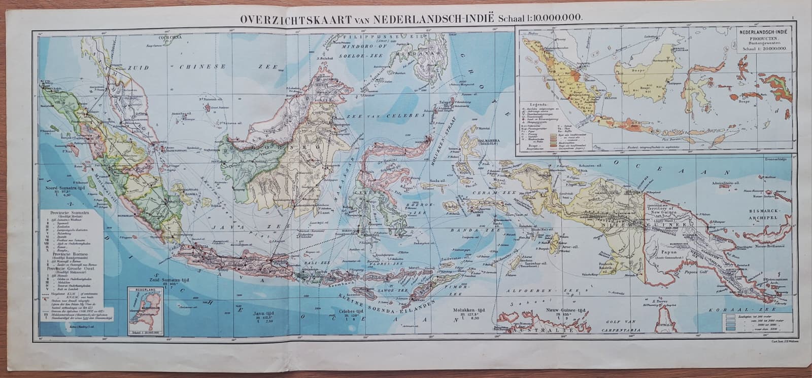
Netherlands East Indies - General Map
1937
- 68x28cm
Detailed and colorful map of Indonesian islands and Singapore. Showing air connections, mail boat connections, timezones etc
Thank you! I will get back to you.
Oops! Something went wrong while submitting the form.